
 16
16


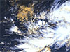
The Meteorology Department says the depression over southwest Bay of Bengal is located near latitude 10.3°N and longitude 85.3°E, at 11:30 p.m.
on Friday (Dec.01) and about 490km northeast of Trincomalee.It is likely to develop into a deep depression during next 12 hours and further into a cyclonic storm by tomorrow (Dec.03).
The system is expected to move west - northwestward near North coast of Sri Lanka towards North Tamil Nadu coast of India by Tuesday (Dec.05).In its weather forecast today, the Meteorology Department mentioned that cloudy skies can be expected over most parts of the island.Showers or thundershowers will occur at times in Northern, North-central, Eastern and North-western provinces and heavy showers above 100mm are likely at some places.Showers or thundershowers will occur in parts of other provinces of the island after 1:00 p.m.
Showers may occur in Southern and Western provinces in the morning as well.Strong winds of about 40-50 kmph can be expected at times over the Northern, Northcentral, Northwestern and Southern provinces and in Trincomalee and Batticaloa districts.The general public is advised to take adequate precautions to minimize damages caused by temporary localized strong winds and lightning during thundershowers.Sea areas:Due to the depression over southwest Bay of Bengal, the Meteorology Department says it is dangerous to engage in activities in the sea areas off the coast extending from Mannar to Pottuvil via Kankesanturai, Trincomalee and Batticaloa.Hence, Naval and fishing communities are advised not to venture into the above sea areas until further notice.Naval and fishing communities engaged in activities in the sea areas off the coast extending from Galle to Pottuvil via Matara are request to exercise caution.
They are also advised to be attentive to future forecasts issued by the department in this regard. Showers or thundershowers will occur at times off the coast extending from Puttalam to Galle via Mannar, Kankesanturai, Trincomalee, Pottuvil and Hambantota.
Showers or thundershowers will occur at several places in the other sea areas around the island particularly in the evening or at night.Winds will be north-westerly or westerly and wind speed will be 30-40 kmph in the sea areas around the island.
Wind speed may increase up to 60-70 kmph in the sea areas off the coast extending from Mannar to Pottuvil via Kankesanturai, Trincomalee and Batticaloa and up to 50-60 kmph in the sea areas off the coast extending from Galle to Pottuvil via Hambantota.The sea areas off the coast extending from Mannar to Pottuvil via Kankesanturai, Trincomalee and Batticaloa will be very rough at times. The sea areas off the coast extending from Galle to Pottuvil via Hambantota can be rough at times and the other sea areas around the Island can be fairly rough at times.
Temporarily strong gusty winds and very rough seas can be expected during thundershowers.