INSUBCONTINENT EXCLUSIVE:
Forests, Range, and Watershed Management Organization, has said.The Iranian Space Agency launched "Khayyam" with a wide range of
environmental functions in early August
It was put into orbit by a Russian Soyuz rocket from the Baikonur space station in Kazakhstan.The Iranian Space Agency launched "Khayyam"
managing natural disasters, confronting deforestation, monitoring border areas and mining explorations are among the main objectives of the
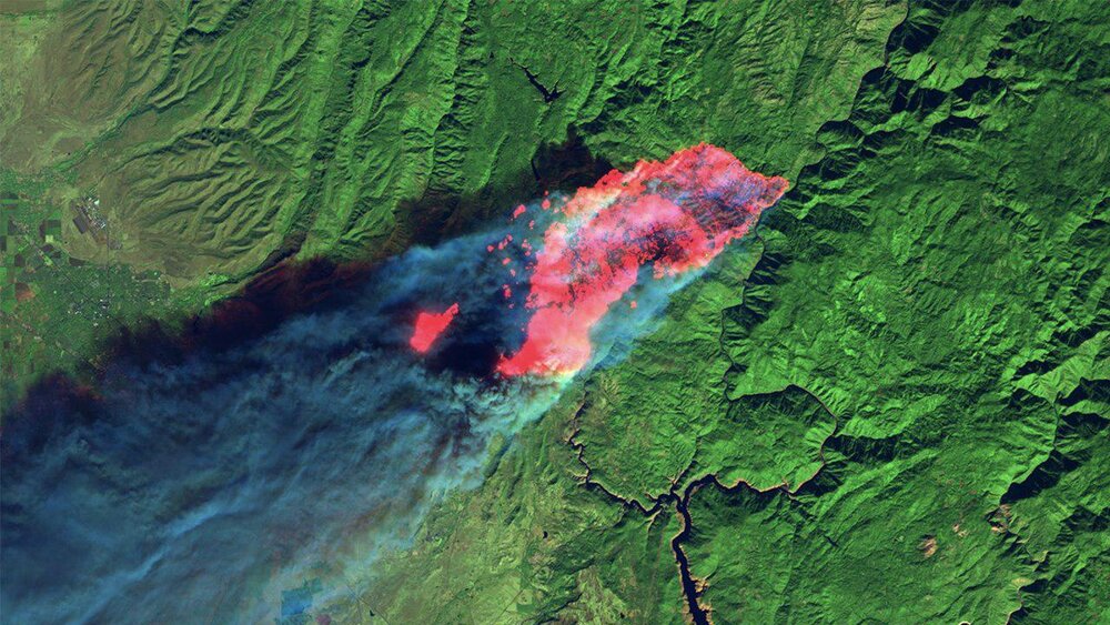
satellite.If a fire occurs in an area during the satellite's rotation, we can record its images at the same moment, and the positive and
significant point of this satellite is that its images are periodic, he stated.In many parts of the world, when some satellites record an
image, a certain period of time passes until the next image is recorded, and in most parts of the world, images are sent with a time
interval of 15 to 20 days, and during this interval, they use other satellites, but we can use Khayyam in different periods to monitor
different areas of the country and have periodic information, he explained.Extracting periodic information from the earth is the most widely
used function of this satellite for systems such as natural resources, agriculture, and geology to use the earth's platform to be
up-to-date at any moment, according to Bayani.Having a satellite with this resolving power can monitor the borders of the country, changes
in vegetation, changes in forests, changes in the boundaries of cities and mines, and how to harvest them, he said.It can level the type of
agricultural products and their quantity and quality in agricultural lands, in addition to monitoring the type of forest species using its