INSUBCONTINENT EXCLUSIVE:
TEHRAN - Aras Geopark in northern Iran came one step closer to possibly being registered by UNESCO on Monday when it gained preliminary
Global Geoparks gained an initial endorsement by experts during the 7th Asia Pacific Geoparks Network Symposium, which was held in
Thailand.Covering an area of about 1670 square kilometers, the geopark is expected to gain UNESCO status in May 2023, if so, it would be the
second geopark in West Asia to be registered on the prestigious list (after Qeshm Geopark), Mehr reported on Tuesday.Earlier this year, prof
Tran Tan Van, a senior assessor from the UNESCO Global Geoparks (UGGp), appreciated the continuous efforts made by the Aras Free Zone
Organization in the realms of studying, identifying, and preserving this geological heritage.The expert made the remarks during a meeting
with the authorities of Aras Geoparks, adding a possible registration would meet strict criteria
An appropriate understanding of geology and how a geopark is formed is not enough to establish and enter the UNESCO Global Geoparks, the
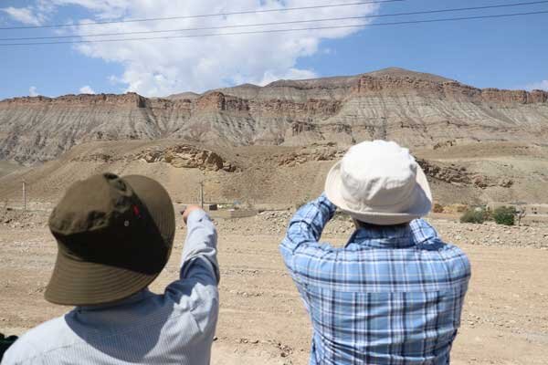
The highest point in the Jolfa region is the Kiyamaki mount with 3,347 meters and the lowest points include the northern boundary and the
Aras River valley with 720 to 390 meters.The property has an appropriate geo-tourism attraction, because of its mountainous landscapes,
outcropping of different sedimentary and igneous rocks, diversity in tectonic structures, semi-cold and semi-arid climate, and diverse flora
and fauna.The UNESCO-designated Qeshm Geopark in the Persian Gulf embraces a wide range of ecotourism attractions such as the Hara marine
forests and about 60 villages dotted mostly across its rocky coastlines
Qeshm Island has an abundance of wildlife, including birds, reptiles, dolphins, and turtles as well.A UNESCO definition of the global
geopark is a unified area with a geological heritage of international significance.Experts say that geoparks help promote awareness of
geological hazards, including volcanoes, earthquakes, and tsunamis, and many help prepare disaster mitigation strategies with local
Moreover, they yield records of past climate changes and are indicators of current climate changes as well.AM